

New Delhi (Gurpreet Singh): Delhi and several parts of northern India witnessed a sharp drop in daytime temperatures on Thursday as rain and thunderstorms affected the region amid the weakening of Cyclone Arnab. Delhi’s Safdarjung weather station recorded a maximum temperature of 25.4 degrees Celsius, around 5.6 degrees below normal and the lowest maximum for an October day since October 8, 2022.
The India Meteorological Department (IMD) issued red and orange alerts for thunderstorms across parts of Delhi-NCR, Uttar Pradesh and other northern states over the following two days. The weather system also brought heavy rainfall to parts of eastern India, while floods and landslides triggered rescue operations in Odisha.
Cyclone Arnab weakened into a depression over south Chhattisgarh and adjoining south Odisha on Thursday morning, a day after making landfall along the Andhra Pradesh and Yanam coast. The IMD expected the system to move northwards and weaken further into a well-marked low-pressure area.
Delhi, Haryana and Punjab Record Below-Normal Temperatures
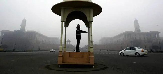
Dark clouds covered Delhi from the morning, although the capital recorded only trace rainfall during the preceding 24 hours. The maximum temperature at Safdarjung settled at 25.4 degrees Celsius, marking the city’s coldest October day in four years in terms of maximum temperature.
Temperatures also remained below normal across Haryana and Punjab. Karnal in Haryana recorded a maximum of 20.6 degrees Celsius, around nine degrees below average, while Ambala registered 23.8 degrees, six degrees below normal.
Narnaul recorded 25.5 degrees Celsius, Rohtak 24.6 degrees and Bhiwani 28 degrees, with the readings reported to be several degrees below normal.
In Punjab, Patiala recorded a maximum temperature of 27.4 degrees Celsius, around three degrees below normal. Ludhiana registered 30.4 degrees, Amritsar 30.6 degrees, Pathankot 29 degrees, Bathinda 31 degrees and Faridkot 34.9 degrees Celsius.
Uttar Pradesh Braces for Further Temperature Drop
The Meteorological Department in Lucknow forecast a fall of around 5–8 degrees Celsius in maximum temperatures across Uttar Pradesh on October 29 and 30.
Thunderstorms and gusty winds were expected in several districts, including Lucknow, Unnao, Rae Bareli, Sultanpur and Amethi. Parts of western Uttar Pradesh could also experience hailstorms on Friday, according to the forecast. Rainfall activity was expected to decrease thereafter.
Rain and Thunderstorms Forecast in Himachal Pradesh and Rajasthan
In Himachal Pradesh, light rain affected some locations, while thunderstorms and lightning were reported in areas including Shimla, Jubberhatti, Sundernagar, Kangra, Murari Devi and Palampur.
The local meteorological centre issued a yellow warning for isolated thunderstorms and lightning in Kangra, Mandi, Shimla and Sirmaur districts on Friday. Kukumseri in Lahaul and Spiti recorded the state’s lowest minimum temperature at minus 1.2 degrees Celsius.
Meanwhile, a fresh western disturbance changed weather conditions across parts of Rajasthan. An induced circulation over Punjab and neighbouring areas was expected to bring rain and strong winds to parts of eastern Rajasthan.
The weather department forecast moderate to heavy rainfall, with isolated hailstorms possible in northern parts of the Jaipur and Bharatpur divisions. Maximum temperatures across the state were expected to fall by 3–5 degrees Celsius over the next 24 hours.
Heavy Rainfall Hits Jharkhand and West Bengal
Heavy rainfall continued across parts of Jharkhand as the weakening weather system moved over central and eastern India.
Gudabanda in East Singhbhum district recorded 71.4 mm of rainfall from Wednesday evening, followed by Manjhari in West Singhbhum with 64 mm. Chaibasa received 60 mm, while Ranchi recorded 26.2 mm during the same period.
Schools in several districts, including Ranchi, West Singhbhum, East Singhbhum and Simdega, had been ordered to remain closed on October 28 and 29 due to the cyclone-related weather conditions.
In West Bengal, rain and squally winds affected parts of the state. The weather department said the system was centred over south Chhattisgarh and adjoining south Odisha, with further movement expected towards the west-northwest.
Odisha Floods Trigger Rescue and Air Evacuation Operations
Odisha faced severe flooding and landslides in parts of the state following the cyclone’s impact. The Indian Coast Guard began airlifting people stranded in affected areas of Ganjam district, while the state government deployed 79 teams from different disaster response agencies for rescue operations in two districts.
Chief Secretary Anu Garg said around 300 villages in Ganjam had been affected by floods, including 70 villages where residents were marooned.
The state government was coordinating with the Union Home Ministry to facilitate air evacuations, she said.
The weather system’s weakening did not immediately end the risks associated with heavy rainfall and flooding. Authorities across affected states continued to monitor conditions and organise response measures as the system moved inland.
