
Chandigarh (Gurpreet Singh): After days of blistering temperatures across northern India, fresh weather developments have sparked expectations of some relief as a strong western disturbance moves closer to the region.
New satellite observations from the India Meteorological Department indicate a large atmospheric system stretching across Afghanistan, Pakistan and adjoining parts of northwest India. The weather activity, captured through advanced thermal imaging, points to rising instability that could trigger thunderstorms and scattered showers over several northern states in the coming days.
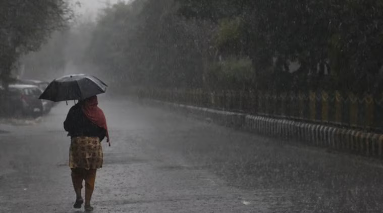
The development comes as much of north and central India continues to struggle under punishing heatwave conditions. Several cities across Punjab, Haryana, Delhi, Rajasthan and western Uttar Pradesh have recorded temperatures above 45 degrees Celsius, while unusually warm nights have made conditions even more uncomfortable.
Meteorologists say nighttime heat poses a major health concern because it prevents the body from recovering after prolonged daytime exposure. The continuing high overnight temperatures have increased risks for vulnerable groups, especially children, elderly people and outdoor workers.
Experts believe the incoming western disturbance may interact with moisture-laden winds from both the Arabian Sea and Bay of Bengal, increasing the likelihood of sudden weather changes. This combination often results in dust storms, lightning, strong gusty winds and short but intense rainfall spells.
Satellite data shows dense cloud activity concentrated over northern Pakistan and Jammu and Kashmir, a sign that the system is strengthening as it approaches India. Similar cloud formations over northeastern parts of the country also suggest active pre-monsoon weather patterns.
Weather officials expect the disturbance to influence Jammu and Kashmir, Himachal Pradesh, Uttarakhand, Punjab, Haryana, Chandigarh, Delhi and parts of western Uttar Pradesh over the next few days. While rainfall coverage may remain patchy, isolated thunderstorms and dust storms are considered likely.
The system is also expected to bring a moderate fall in temperatures, especially during the night, offering some relief from the exhausting heat that has dominated recent days.
Meanwhile, increased cloud activity over the Arabian Sea and southern Bay of Bengal is being closely watched, as it may signal the gradual strengthening of broader monsoon conditions.
Though this weather shift may not completely end the current heatwave, it is expected to soften its intensity and provide temporary respite for millions enduring one of the harshest spells of summer this season.